Feather Fanfare

Birdwatch at Ravenswood Preserve in the South Bay
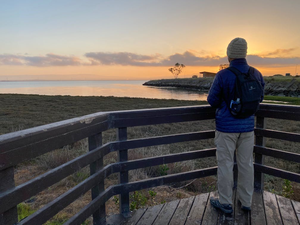
Man standing at boardwalk overlooking the wetland at Ravenswood Preserve

Feathery birds swing and swoop on the edge of the San Francisco Bay, surrounded by the Diablo Range and Santa Cruz Mountains. Seeing it all from a levee in Ravenswood Preserve makes a wonderful morning stroll. Combined with neighboring Cooley Landing Park, there are 2.2 miles of trails off Bay Road to explore. They’re mostly flat, with observation decks and benches to soak up the views.

From Cooley Landing Park, head west on a paved trail to Ravenswood Bridge. Cross to the wide asphalt Bay Trail, a great option for strollers and wheelchairs. To the right is a 0.1-mile paved spur to the southern observation deck. To the left, the Bay Trail continues north towards the northern observation deck. (Note: The last 0.5 mile to the northern observation deck is gravel.)

Both decks overlook the edge of the San Francisco Bay, where birds like the endangered Ridgway’s rail, as well as American avocets, ducks, herons, and egrets hunt the mudflats for food. It’s very beautiful and peaceful watching their signature birdie hops, bathing routines, and little chicks in tow. Bring binoculars if you can.

As you stroll along the Bay Trail, tides channel in and out of the yellow-green and soft brown marshland. Just 0.7 mile north of the Ravenswood Bridge is a newly built wooden boardwalk with educational panels and benches. The boardwalk transitions to a paved ADA-accessible trail connecting to University Avenue. 

This 0.6-mile boardwalk and paved trail combo was just completed in 2020, a critical missing link in the planned 500-mile San Francisco Bay Trail. Now that it’s built, bicyclists and pedestrians are connected to 80 continuous miles of the Bay Trail that link neighboring communities and parks, including the Dumbarton Bridge.

Directions: Ravenswood Preserve is located in East Palo Alto, just south of the Dumbarton Bridge. The main Midpen parking lot on Bay Road is closed through September 2021, but parking is available at Cooley Landing Park, 2100 Bay Road, East Palo Alto. A 0.3-mile paved trail connects Cooley Landing Park to Ravenswood Preserve. Ravenswood Preserve is open a half-hour before sunrise to a half-hour after sunset. Cooley Landing Park is open from sunrise to sunset. No dogs.

Story and Photos by Melissa Ozbek, @melissaozbek.

Trending Stories NorCal

View all Stories
  1. Taking the Stage: Tyler Ranch

    Hike the recently opened Tyler Ranch Staging Area in Pleasanton Ridge Regional Park, with 18 miles of new trails. This 6.5-mile loop up Sunol Peak is a challenge and rewards with exceptional views of seasonal iridescent hills.

    View
  2. A woman stands at Dante's View in Death Valley, looking out to Telescope Peak and Manly Lake, Badwater Basin below.

    Sunset Hike (and Manly Lake Vista!) at Dante's View

    It’s one of the world’s best places to watch a sunset. Dante’s View is a 5,476-foot vantage of the whole southern basin of Death Valley from the top of the Black Mountains. On clear days you get views of both the highest and lowest points in the contiguous U.S. 

    View
  3. Swing into Spring

    Swing into this 7.1-mile hike in the hills of Half Moon Bay! It’s got gorgeous views, fields of spring wildflowers, and a hidden rustic tree swing.

    View
  4. The Carson Show

    Carson Falls is ready for primetime. This three-tiered, 100-foot stunner is hidden back in a canyon outside of Fairfax and reached on a 3.25-mile (round-trip) hike.

    View

Trending Stories SoCal

View all Stories
  1. Lava Lava

    Once a land of volcanic activity, Mojave National Preserve shares plenty about its past via a quick yet adventurous hike to the Lava Tube in the Cima Dome Volcanic Field.

    View
  2. Kelso Dunes

    The hike to the top of Kelso Dunes in the Mojave National Preserve is only 3 miles (out and back), but you’ll feel like you’ve hiked much farther by the time you’re done.

    View
  3. William Kenyon Overlook

    Some of the best vistas of Anza-Borrego Desert State Park are easily accessible via a short and sweet 1.25-mile (round-trip) hike just off the CA-78. Enter your next favorite desert viewpoint: the William Kenyon Overlook.

    View
  4. Beaudry Bountiful

    There are no cars allowed on Beaudry Loop, but this 6-mile hike takes you on a wild ride. You’ll be climbing 1,500 feet up the southern Verdugos along a chaparral-lined trail with gorgeous mountain and urban vistas every step of the way.

    View