Pawfect Double

Dog-friendly LA hike with great views at Upper and Lower Canyonback Trails
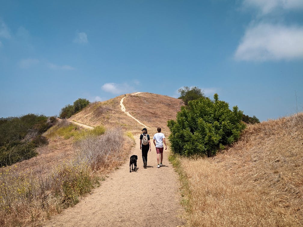
Two hikers and a dog at Upper and Lower Canyonback Trails in Los Angeles County

It might be the best doggone hike in LA! Double up on the fur-friended fun in the northeastern Santa Monica Mountains of the San Fernando Valley. Upper and Lower Canyonback Trails deliver a 7.75-mile (round-trip) moderate workout over two loops and countless panoramic city views. All in, it’s 800 feet of elevation gain. Starting at the Upper Canyonback trailhead, choose a fire road or a narrow use trail along the ridge heading south; both provide wonderful views (consider taking one on the way down and the other on the way back); and both allow for off-leash adventuring with your dog.

Hiker and a dog at Upper and Lower Canyonback Trails in the Santa Monica Mountains

Dog drinking out of a waterbowl at a dog station at Upper and Lower Canyonback Trails in Los Angeles County

Two hikers coming to the crest of a trail at Upper and Lower Canyonback Trails in Los Angeles county

There’s a short spur trail on the left accessed by a short, steep climb (and quite a workout for you and your pup) to Canyonback Cairn with, you guessed it, multiple rock cairns balancing over the canyon. You can also opt for a side trip to the famous Cold War–era Nike Missile Site via the connecting Hollyhock fire road through Mandeville Canyon. Otherwise, the Upper Canyonback route continues south, with canyon views to the west as well as the summits of the Santa Monica Mountains and the Pacific. At the terminus of the Upper Canyonback Trail, take a short jaunt on the paved road to reach the Lower Canyonback Trail, which continues down to Brentwood.

Group of four hikers on a wide dirt trail at Upper and Lower Canyonback Trails in Santa Monica Mountains

Two hikers with a dog going along a wide dirt trail at Upper and Lower Canyonback Trails in Los Angeles County

Along the way, find an ancient oak tree with a wooden bench swing. The ridge here has vast vistas as well as a great spot to rest those paws. After about 2 miles, the trail ends—this is your turnaround point for a difficult ascent back up to the dirt lot (or street parking) and your car. Be sure to stop at Chili’s Watering Hole on the fire road through Upper Canyonback, a memorial to a local pooch that now serves as a hydration station for resident rovers.

To get to the Upper Canyonback trailhead and lot, take the US-101 to Hayvenhurst Ave. and head south for 2 miles. Then, take a right onto Encino Hills Dr. After 1 mile, find the dirt lot or street parking and the trailhead. Alternatively, take the I-405 to Mulholland Dr. and head west for 3 miles to the trailhead. Dog-friendly (off-leash area included)!

Story and photos by Matt Pawlik

Trending Stories NorCal

View all Stories
  1. Taking the Stage: Tyler Ranch

    Hike the recently opened Tyler Ranch Staging Area in Pleasanton Ridge Regional Park, with 18 miles of new trails. This 6.5-mile loop up Sunol Peak is a challenge and rewards with exceptional views of seasonal iridescent hills.

    View
  2. A woman stands at Dante's View in Death Valley, looking out to Telescope Peak and Manly Lake, Badwater Basin below.

    Sunset Hike (and Manly Lake Vista!) at Dante's View

    It’s one of the world’s best places to watch a sunset. Dante’s View is a 5,476-foot vantage of the whole southern basin of Death Valley from the top of the Black Mountains. On clear days you get views of both the highest and lowest points in the contiguous U.S. 

    View
  3. Swing into Spring

    Swing into this 7.1-mile hike in the hills of Half Moon Bay! It’s got gorgeous views, fields of spring wildflowers, and a hidden rustic tree swing.

    View
  4. The Carson Show

    Carson Falls is ready for primetime. This three-tiered, 100-foot stunner is hidden back in a canyon outside of Fairfax and reached on a 3.25-mile (round-trip) hike.

    View

Trending Stories SoCal

View all Stories
  1. Lava Lava

    Once a land of volcanic activity, Mojave National Preserve shares plenty about its past via a quick yet adventurous hike to the Lava Tube in the Cima Dome Volcanic Field.

    View
  2. Kelso Dunes

    The hike to the top of Kelso Dunes in the Mojave National Preserve is only 3 miles (out and back), but you’ll feel like you’ve hiked much farther by the time you’re done.

    View
  3. William Kenyon Overlook

    Some of the best vistas of Anza-Borrego Desert State Park are easily accessible via a short and sweet 1.25-mile (round-trip) hike just off the CA-78. Enter your next favorite desert viewpoint: the William Kenyon Overlook.

    View
  4. Beaudry Bountiful

    There are no cars allowed on Beaudry Loop, but this 6-mile hike takes you on a wild ride. You’ll be climbing 1,500 feet up the southern Verdugos along a chaparral-lined trail with gorgeous mountain and urban vistas every step of the way.

    View