Arrowhead Ahead

Fall Color Hike on Sawmill Road Loop Trail Near Lake Arrowhead

Fall Color Hike Sawmill Road Near Lake Arrowhead

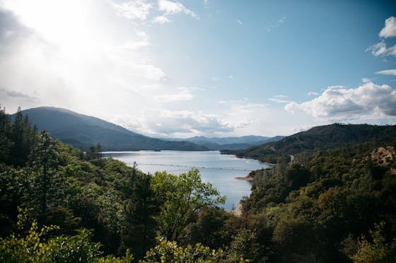
Deciduous black oaks and Fremont cottonwoods line the Sawmill Road Loop Trail near Lake Arrowhead, making the 2.9-mile (round-trip) hike one of the best in SoCal for a seasonal kaleidoscope of changing leaves.

Starting from the trailhead, you’re almost immediately immersed in shade cast by the yellow and green leaves of the black oaks. Continue farther along to see the green valleys of the San Bernardinos peppered with golden yellows. The first 1.8-mile segment of the trek follows Rouse Ranch Road—mostly downhill, with some slight incline, on the popular off-roading route. When you hook left at the sign marked “to 2N29Y,” you’ll link up with Sawmill Road.

At about 1.9 miles you’ll rapidly ascend 150 feet. The greater height brings greater views, as well as less shade. Just past 2 miles, turn left off Sawmill Road onto a narrow trail where the off-roaders can’t go—this section is just for hikers. Here you’ll see many of the Fremont cottonwoods and some of the starkest yellow leaves, in the trees and carpeting the ground. You’ll also get a brief view of Lake Arrowhead through the foliage.

When you reach pavement, you’ll be passing through North Shore Campground. Follow the pavement as far left as it will go and you’ll find the last bit of trail heading downhill to where you parked. This is also your last chance to soak in those autumn colors.

From CA-18 (Rim of the World Hwy.) in Lake Arrowhead, turn north onto CA-173 for 2.6 miles and then turn right on Torrey Rd. Continue straight onto Rouse Ranch Rd. and drive past the pavement onto the dirt road for a short distance. A large dirt parking area is on the right side of the road. Parking coordinates: 34.266179, -117.161860. Dog-friendly!

Trending Stories NorCal

View all Stories
  1. Taking the Stage: Tyler Ranch

    Hike the recently opened Tyler Ranch Staging Area in Pleasanton Ridge Regional Park, with 18 miles of new trails. This 6.5-mile loop up Sunol Peak is a challenge and rewards with exceptional views of seasonal iridescent hills.

    View
  2. A woman stands at Dante's View in Death Valley, looking out to Telescope Peak and Manly Lake, Badwater Basin below.

    Sunset Hike (and Manly Lake Vista!) at Dante's View

    It’s one of the world’s best places to watch a sunset. Dante’s View is a 5,476-foot vantage of the whole southern basin of Death Valley from the top of the Black Mountains. On clear days you get views of both the highest and lowest points in the contiguous U.S. 

    View
  3. Swing into Spring

    Swing into this 7.1-mile hike in the hills of Half Moon Bay! It’s got gorgeous views, fields of spring wildflowers, and a hidden rustic tree swing.

    View
  4. The Carson Show

    Carson Falls is ready for primetime. This three-tiered, 100-foot stunner is hidden back in a canyon outside of Fairfax and reached on a 3.25-mile (round-trip) hike.

    View

Trending Stories SoCal

View all Stories
  1. Lava Lava

    Once a land of volcanic activity, Mojave National Preserve shares plenty about its past via a quick yet adventurous hike to the Lava Tube in the Cima Dome Volcanic Field.

    View
  2. Kelso Dunes

    The hike to the top of Kelso Dunes in the Mojave National Preserve is only 3 miles (out and back), but you’ll feel like you’ve hiked much farther by the time you’re done.

    View
  3. William Kenyon Overlook

    Some of the best vistas of Anza-Borrego Desert State Park are easily accessible via a short and sweet 1.25-mile (round-trip) hike just off the CA-78. Enter your next favorite desert viewpoint: the William Kenyon Overlook.

    View
  4. Beaudry Bountiful

    There are no cars allowed on Beaudry Loop, but this 6-mile hike takes you on a wild ride. You’ll be climbing 1,500 feet up the southern Verdugos along a chaparral-lined trail with gorgeous mountain and urban vistas every step of the way.

    View