Footloose in the Foothills

Hike Diablo Foothills Regional Park in the East Bay
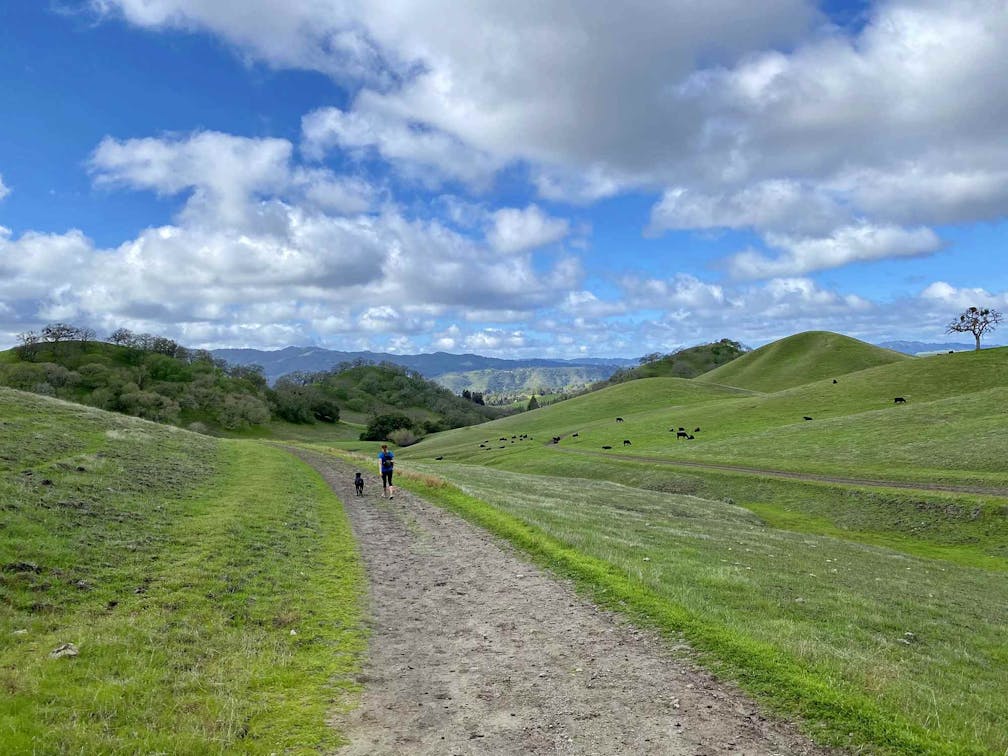
Hiker at Diablo Foothills Regional Park in the East Bay

Diablo Foothills Regional Park is known for its interesting geological formations, but it’s also got a bigger attraction in spring: green rolling hills that help deliver some of the lushest views of Mount Diablo itself. This beautiful 8-mile loop takes you through the majority of the park’s scenic terrain.

Hikers on a trail at Diablo Foothills Regional Park

Hiker and dog at Diablo Foothills Regional Park in the East Bay

Start at the Castle Rock Trail parking lot entrance and take the trail headed south towards the park office. At the first junction, head right to begin the main climb. As you approach the false peak, keep to the left for the Shell Ridge Trail (which begins after a quick drop). Keep left, dipping onto a singletrack trail that weaves through a thicket of ridgeside trees. At your next junction, head right to finish this climb and get the big reward: unobstructed views of Mount Diablo along with a bird’s-eye view of the razor-like rock formations that make up the park’s popular Mammoth Rock. You’ll also have views of the verdant open space for miles.

Person and dog sitting at a bench overlooking the green spring hills at Diablo Foothills Regional Park in the East Bay

After descending into the valley below, keep to the right on the Fairy Lantern Trail, which bursts from the trees into green meadows soon to be blossoming in wildflowers. Follow the Briones to Mount Diablo Regional Trail and continue your climb out of the tree-filled valleys below and get your fill of Mount Diablo views.

Finish up by combining Wall Point Road as it transitions to Dusty Road and then on to Stage Road. Making your way through patches of thick forest and over some small creek crossings, you can see Mammoth Rock in the distance. Once you pass the dam, turn around for a last look at the spiny rock formation on the hillside. At the cattle gate, keep left to follow the connector trail back to where you started.

The hike begins at the Castle Rock Trail entrance, adjacent to the North Peak Equestrian Center. The parking lot offers ample parking; however, we recommend that you begin your hike early since the hike is partially exposed. No water is available at the trailhead. Restrooms available. Dog-friendly!

Story and photos by Brad Hyland, @bradhylandphotography

Trending Stories NorCal

View all Stories
  1. Taking the Stage: Tyler Ranch

    Hike the recently opened Tyler Ranch Staging Area in Pleasanton Ridge Regional Park, with 18 miles of new trails. This 6.5-mile loop up Sunol Peak is a challenge and rewards with exceptional views of seasonal iridescent hills.

    View
  2. A woman stands at Dante's View in Death Valley, looking out to Telescope Peak and Manly Lake, Badwater Basin below.

    Sunset Hike (and Manly Lake Vista!) at Dante's View

    It’s one of the world’s best places to watch a sunset. Dante’s View is a 5,476-foot vantage of the whole southern basin of Death Valley from the top of the Black Mountains. On clear days you get views of both the highest and lowest points in the contiguous U.S. 

    View
  3. Swing into Spring

    Swing into this 7.1-mile hike in the hills of Half Moon Bay! It’s got gorgeous views, fields of spring wildflowers, and a hidden rustic tree swing.

    View
  4. The Carson Show

    Carson Falls is ready for primetime. This three-tiered, 100-foot stunner is hidden back in a canyon outside of Fairfax and reached on a 3.25-mile (round-trip) hike.

    View

Trending Stories SoCal

View all Stories
  1. Lava Lava

    Once a land of volcanic activity, Mojave National Preserve shares plenty about its past via a quick yet adventurous hike to the Lava Tube in the Cima Dome Volcanic Field.

    View
  2. Kelso Dunes

    The hike to the top of Kelso Dunes in the Mojave National Preserve is only 3 miles (out and back), but you’ll feel like you’ve hiked much farther by the time you’re done.

    View
  3. William Kenyon Overlook

    Some of the best vistas of Anza-Borrego Desert State Park are easily accessible via a short and sweet 1.25-mile (round-trip) hike just off the CA-78. Enter your next favorite desert viewpoint: the William Kenyon Overlook.

    View
  4. Beaudry Bountiful

    There are no cars allowed on Beaudry Loop, but this 6-mile hike takes you on a wild ride. You’ll be climbing 1,500 feet up the southern Verdugos along a chaparral-lined trail with gorgeous mountain and urban vistas every step of the way.

    View