Anonymous Source
Hike to an Unnamed Waterfall in the Cleveland National Forest

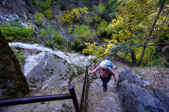
Hidden in the Cleveland National Forest near Los Pinos Springs is a waterfall so unknown it doesn’t have a name yet and neither does the 2.6-mile (round-trip) out-and-back trail to find it. But the path immediately immerses you in a feeling of wilderness with the peaceful sounds of running water and the cool shade of the dense forest.
The trailhead is marked only by three short posts in the ground directly in front of the parking area. You may have to duck under some low-hanging tree branches, but you will be instantly plunged into a wide-open field surrounded by Jeffrey pines and canyon live oaks. Hard to believe you’re only 20 yards from your car! After the field, the trail weaves through a natural tunnel of branches (the first of many) and remains mostly shaded for the first quarter-mile.
You’ll soon come upon the stream that will serve as your guide to the waterfall. The trail never veers far from it. The few times it’s out of sight, due to dense foliage, it remains within earshot. As long as you stick by the stream, you will find the falls without any trouble. Along the way you’ll hear the croaks of California tree frogs, though they can be hard to spot. You’ll pass through tight spaces of branches and wide-open clearings intermittently, and you’ll cross the creek a few times. Close to a mile in, you’ll start seeing large patches of California buckwheat. You will hear the waterfall before you arrive at the crest of it. There’s plenty of surrounding rock formations to scramble up and lounge upon as you enjoy the falls up close and safely. Maybe you’ve earned naming rights!
WILDFLOWER BONUS: If you head up to No Name Falls via CA-74 through Lake Elsinore, you can stop off at a spot directly off the highway that looks over Lake Elsinore and gives you a panoramic view of the superbloom of poppies in Walker Canyon.
From the I-15, take the exit for CA-74/Central Ave. and head west. Make a quick right on Collier Ave. and a quick left onto Riverside Dr. Make a left on Grand Ave. and then a right turn to stay on CA-74. Follow CA-74 for 6.5 miles up the mountain, then take a right on Main Divide Truck Trail. After 0.6 mile, stay on the paved road to continue onto Long Canyon Rd. Stay on Long Canyon Rd. for 2 miles. You’ll see a parking area just past the fork of Long Canyon Rd. and Hot Spring Canyon just outside the Falcon Group Campground. The coordinates for the trailhead are 33.657731,-117.450938.


