Tam It All

Hike to Cataract Falls on Mount Tam in Marin
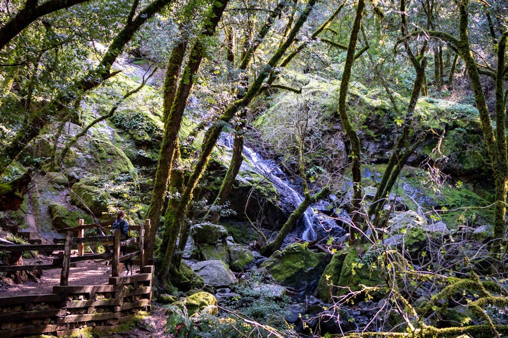
Woman at overlook watching Cataract Falls on Mount Tam in Marin

The hills have gone green just in time for St. Patrick’s Day, and this 7.5-mile lollipop loop hike passes through some of Mount Tam’s lushest spots, with bridges, creeks, a waterfall, and big views.

woman walking dog through mount tam

woman walking over bridge in woodland

Woman walking dog over hills

Start your hike on the Cataract Trail from the Rock Spring Trailhead. The trail quickly dips into the moss-covered forest and meanders the upper section of Cataract Creek. Take a right at the junction of Cataract and Barth’s Creeks onto the Mickey O’Brien Trail. Barth’s Creek gives a soothing ambiance to the forest as you climb into a clearing at Barth’s Retreat. Continue up the ridge and take a right onto the Laurel Dell Fire Road for open views of foothills below.

Woman hiking at Mount Tam to Cataract Falls

After a quick descent into Potrero Camp, keep left and hop onto the Kent Trail. After a short distance, stay to the left to take the Cross Country Boys Trail. The trail changes from forest to manzanita-lined paths and offers glimpses of the valleys below from time to time. At the small pond known as High Marsh, take a left onto the High Marsh Trail, which will lead you back to Cataract Creek. As you approach the creek, you’ll burst out of the forest into a grassy ridgeside. This beautiful section should offer up a mix of flowers in the coming weeks.

woman looking at waterfall

Man standing at Mount Tam vantage overlooking the San Francisco skyline

After dipping back into the forest, you’ll begin to hear Cataract Falls. The sound of water is a constant companion even if you don’t yet see the falls—the first of which is reached immediately at the bottom of the steps. To see more and add some distance to the hike, keep going down the steps to see deep grottoes created by the multi-flowing tiers. After getting your fill of the falls, make your way back up the canyon and steps to continue along Cataract Trail to the Laurel Dell picnic area, an oasis in its own right, shrouded in redwoods and green ferns. Continue past the restroom to resume your hike alongside the creek.

Bonus: Once you have returned to the parking lot, cross Ridgecrest Boulevard and hike up the small hill. From this vantage point, you’ll have the Golden Gate spires, San Francisco, the Pacific, and the East Bay in your sights. 

The hike begins at the Rock Spring Trailhead off Ridgecrest Blvd. The parking lot offers ample parking; however, we recommend that you begin your hike early due the popularity of the falls. No water is available at the trailhead. Restrooms available. Dog-friendly!

Trending Stories NorCal

View all Stories
  1. Taking the Stage: Tyler Ranch

    Hike the recently opened Tyler Ranch Staging Area in Pleasanton Ridge Regional Park, with 18 miles of new trails. This 6.5-mile loop up Sunol Peak is a challenge and rewards with exceptional views of seasonal iridescent hills.

    View
  2. A woman stands at Dante's View in Death Valley, looking out to Telescope Peak and Manly Lake, Badwater Basin below.

    Sunset Hike (and Manly Lake Vista!) at Dante's View

    It’s one of the world’s best places to watch a sunset. Dante’s View is a 5,476-foot vantage of the whole southern basin of Death Valley from the top of the Black Mountains. On clear days you get views of both the highest and lowest points in the contiguous U.S. 

    View
  3. Swing into Spring

    Swing into this 7.1-mile hike in the hills of Half Moon Bay! It’s got gorgeous views, fields of spring wildflowers, and a hidden rustic tree swing.

    View
  4. The Carson Show

    Carson Falls is ready for primetime. This three-tiered, 100-foot stunner is hidden back in a canyon outside of Fairfax and reached on a 3.25-mile (round-trip) hike.

    View

Trending Stories SoCal

View all Stories
  1. Lava Lava

    Once a land of volcanic activity, Mojave National Preserve shares plenty about its past via a quick yet adventurous hike to the Lava Tube in the Cima Dome Volcanic Field.

    View
  2. Kelso Dunes

    The hike to the top of Kelso Dunes in the Mojave National Preserve is only 3 miles (out and back), but you’ll feel like you’ve hiked much farther by the time you’re done.

    View
  3. William Kenyon Overlook

    Some of the best vistas of Anza-Borrego Desert State Park are easily accessible via a short and sweet 1.25-mile (round-trip) hike just off the CA-78. Enter your next favorite desert viewpoint: the William Kenyon Overlook.

    View
  4. Beaudry Bountiful

    There are no cars allowed on Beaudry Loop, but this 6-mile hike takes you on a wild ride. You’ll be climbing 1,500 feet up the southern Verdugos along a chaparral-lined trail with gorgeous mountain and urban vistas every step of the way.

    View