Topanga Aerie
Hiking to Eagle Rock in Topanga State Park


You’ll feel like an eagle when you reach the top of Eagle Rock, crown of Topanga State Park. The massive, pockmarked sandstone slab is a blast to hike to, play on, and perch atop of, with its eagle’s-eye view of the Santa Monica Mountains, Pacific Ocean, and the San Fernando Valley.
Reach Eagle Rock on a 4-mile (round-trip) via the Musch Trail by heading up the marked path from the trailhead until you reach a T-junction, where you head left and start climbing. You’ll pass clusters of oaks, wild agave, and countless scurrying critters along the well-maintained trail.


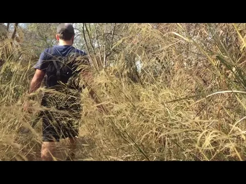
After a half-mile, you’ll reach the Musch Hike-In Camp, complete with flush toilets. Continue on Musch Trail through wide-open blue-gray grass fields and shady forest clusters. The crisp morning air and sharp visibility make late fall and winter a great time to take this journey.


Continue for 1.1 miles until you reach a junction with East Topanga Fire Road and Eagle Springs Fire Road. You’ll see the Pacific Ocean to the south and all of Topanga Canyon to the north. More views lie ahead! Take the hard-left trail (East Topanga Fire Road) to complete your journey to the aerie, 1,930 feet above sea level. Scamper up the stunning rock formation, explore its nooks and crannies, and leave a note in the journal inside a cave near the natural stone arch. When you’ve had your fill of the vista, head back the way you came—the coffee’s brewing!
CAFFEINATE IT: The Topanga Table offers delicious locally sourced cuisine in a relaxed atmosphere tucked away in the Santa Monica Mountains. To get there, drive 1.2 miles north on Topanga Canyon Road (CA-27) from the Hillside Drive intersection. Get your caffeine fix with an organic cappuccino, and pair savory and sweet with their specialty breakfast burrito (complete with out-of-this-world breakfast potatoes) and delicious French toast, as you thank your lucky stars you live in Southern California.
To reach Musch Trail from Pacific Coast Hwy., head north on CA-27 (Topanga Canyon Blvd.) for 5.8 miles and turn right on Hillside Dr. From US-101, take the CA-27 exit, head south 7.4 miles, and turn left on Hillside Dr. Continue 0.5 mile to the dead-end and park along the street. No dogs on the state park trails, but Topanga Table is dog-friendly!


