A Frame for the Sky
Hiking to Vanalden Cave in the Santa Monica Mountains

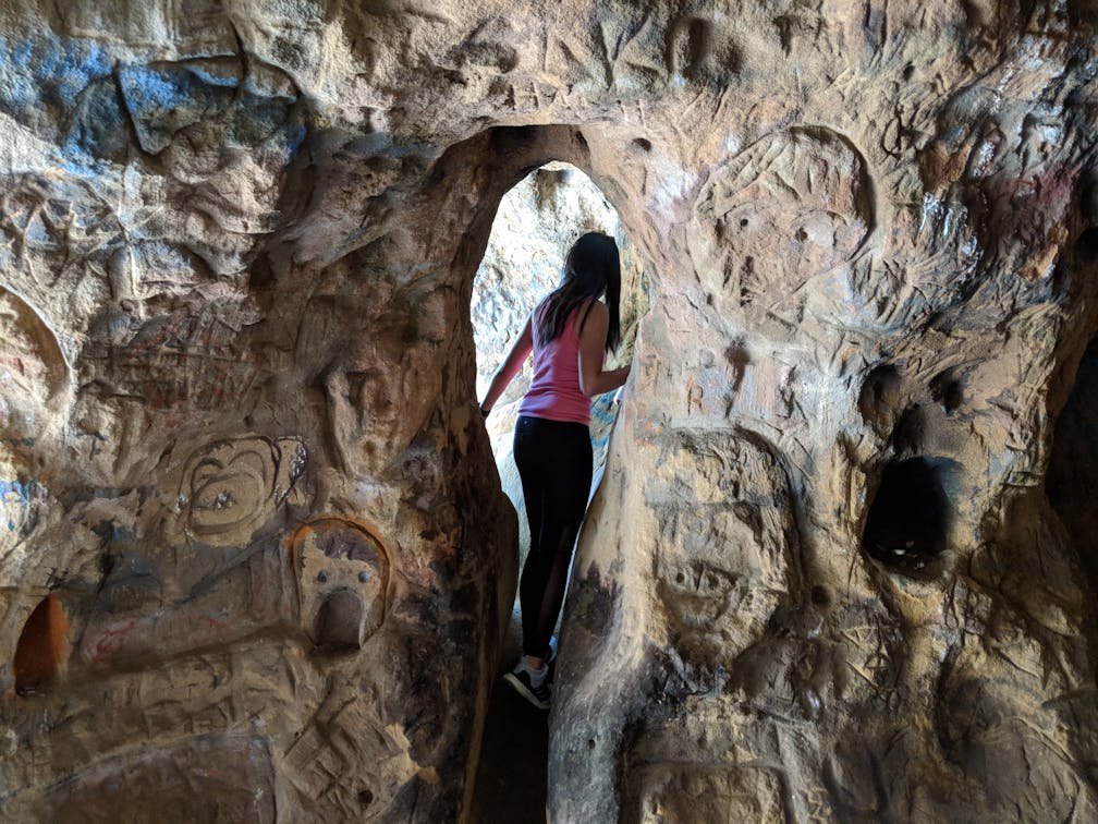
Vanalden Cave in the Santa Monica Mountains is more a picture frame for landscape and sky than it is a hideaway hole in the ground. It’s just a 1.5-mile (round-trip) hike on an out-and-back trail to reach an impressively large sandstone chamber with holes in the ceiling that let in dramatic pockets of sunshine.

At the start of the hike you pass under a giant, welcoming shade tree and follow a narrow, gradually ascending and slightly technical singletrack trail for a quarter-mile to the first junction. You will share the path with scurrying alligator lizards, overgrown mustard plants, and other chaparral commons (look for Indian paintbrush!).

Take the left path, enjoying valley vistas with the Santa Susanas as backdrop before descending into thriving, green woodland and much-welcome shade. Ignore the first junction and continue to a T-junction, where you should turn right, following a dry creek bed along a small cliff wall.
Soon enough, there it is: swirls of sandstone punctuated with openings to the sky. Of course, the sun that shines through also illuminates unfortunate remnants of graffiti and the carvings of vandals. Still, Vanalden Cave is a geological wonder worth visiting. Be sure to release your inner jungle gymnast to explore all the nooks and crannies before heading back.
But don’t beeline home. Not when there are great views to enjoy. When you reach that first junction, this time head left to continue up the hill. You will soon reach a wide fire road (Mulholland Drive) that offers a path to Corbin Canyon to your right and paths leading into Topanga State Park to your left. Head left, but take the next junction to your right on the service road, which eventually leads to Vanalden Vista—a good capping point for some extra mileage and epic views. Head back to your car (or continue meandering through this vast network of Tarzana trails), savoring the chirps and hums of the birds and bees before venturing back into the honks and whirrs of city life.
To get to the Vanalden Cave Trail and street parking, take US-101 to Tampa Ave. and exit south. Take a left onto Ventura Blvd., followed by an immediate right onto Vanalden Ave. Follow this for 3 miles to the end of the road (you’ll see the Santa Monica Mountains Conservancy Parkland sign), parking, and the trailhead. Dog-friendly!


