Carr Ranch

Go on a long hike at Carr Ranch Trail in Contra Consta County
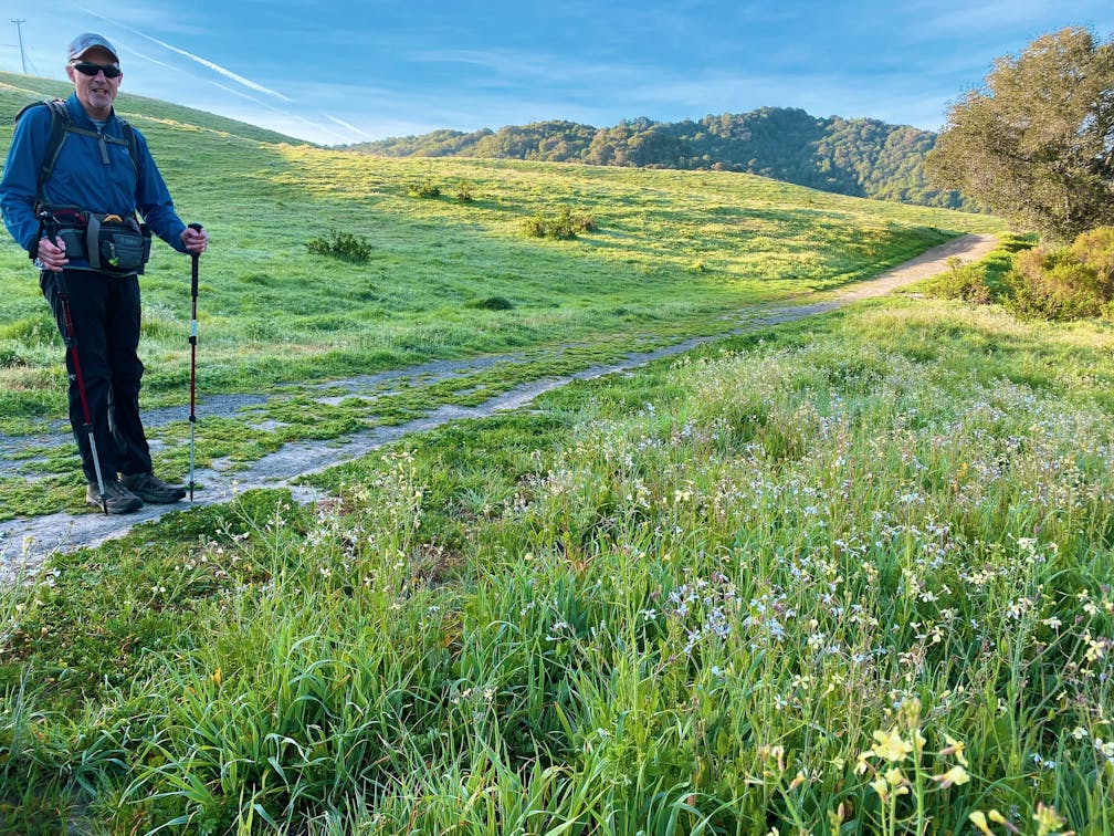
Hiker on a trail with beautiful green hills and wildflowers on the grasses at Carr Ranch in Contra Costa County

{March 16, 2023 Update: Given the recent weather, please check ahead before visiting sites to check on any trail closures, and be mindful that mud and debris hazards are possible if visiting after storms. Exercise good judgement and caution for safety.}

Can’t decide between an epic hike or a relaxing nature walk? The 8.3-mile Carr Ranch Trail loop in the East Bay’s Contra Costa County has you covered for both! With 2,000 feet of elevation gain through fields of spring wildflowers, this is the perfect hike for rugged adventurers with a soft side.

View of a water reservoir that cattle are surrounding at Carr Ranch in Contra Costa County

From the Rancho Laguna parking lot, walk to the southeast corner of the park. Scan the QR code on the trailhead billboard to purchase a trail permit, and then head out on the Rancho Laguna Trail.

Hiker standing at a trail sign with green rolling hills and trees in the background at Carr Ranch in Contra Costa County

Hiker sitting on her backpack taking a break at Carr Ranch Loop in Contra Costa County

Hiker going up at trail at Carr Ranch in Contra Costa County

Turn left onto Rocky Ridge Trail, a path best explored in the early morning, when the fields are covered in dew. As the sun comes over the hilltops, the white and purple wild radish flower sparkles everywhere. Hikers may not even realize they’re summiting the first hill of the journey: a 1,000-foot vista point. Of note, while the wild radish flower here looks beautiful, it’s actually an invasive plant that’s a real challenge in the Bay Area because it crowds out native plants.

California Poppy on a trailside at Carr Ranch Loop in Contra Costa County

Wildflowers at Carr Ranch in Contra Costa County

Continue along Rocky Ridge Trail as it descends toward Buckhorn Creek. After a quick break to search for frogs and California newts in the water, turn left onto the Carr Ranch Loop Trail. A steep ascent lies ahead, but some beautiful stretches with bright orange poppies ease the journey. Follow all trail signs for the Carr Ranch Loop until you emerge on the ridgeline to a series of open hilltops with gorgeous views of the surrounding Diablo Range.

Continue along the loop as it passes through cow pasture and fields of sunny buttercups. Patches of clover cover the ground, providing a cushion to weary feet. After a two-mile descent, turn left to complete your loop and return to the Rocky Ridge Trail.

Retrace your steps back to the parking lot.

Rancho Laguna Park is located at 2101 Camino Pablo, Moraga. From Moraga, take Canyon Rd. south, then turn left onto Camino Pablo. Continue for 1.7 miles, then turn left into the park. A $3 trail permit can be purchased at the trailhead. Dog-friendly!

Story and photos by Poe Casavant.

Trending Stories NorCal

View all Stories
  1. A woman stands at Dante's View in Death Valley, looking out to Telescope Peak and Manly Lake, Badwater Basin below.

    Sunset Hike (and Manly Lake Vista!) at Dante's View

    It’s one of the world’s best places to watch a sunset. Dante’s View is a 5,476-foot vantage of the whole southern basin of Death Valley from the top of the Black Mountains. On clear days you get views of both the highest and lowest points in the contiguous U.S. 

    View
  2. The Carson Show

    Carson Falls is ready for primetime. This three-tiered, 100-foot stunner is hidden back in a canyon outside of Fairfax and reached on a 3.25-mile (round-trip) hike.

    View
  3. Sugarloaf Ridge State Park waterfall hike in Sonoma Valley

    Sweet as Sugarloaf

    Right in the heart of wine country there’s plenty more than wine flowing right now, with an oft unheralded waterfall that surges to an exuberant spectacle from all the recent rain.

    View
  4. Taking the Stage: Tyler Ranch

    Hike the recently opened Tyler Ranch Staging Area in Pleasanton Ridge Regional Park, with 18 miles of new trails. This 6.5-mile loop up Sunol Peak is a challenge and rewards with exceptional views of seasonal iridescent hills.

    View

Trending Stories SoCal

View all Stories
  1. Rise and Shine Zabriskie Hike

    The sunrise at Zabriskie Point makes a grand entrance, with the light ascending slowly and washing over the golden badlands. It’s signature Death Valley. It’s also a great starting point for one of the Valley’s marquee hikes.

    View
  2. Kelso Dunes

    The hike to the top of Kelso Dunes in the Mojave National Preserve is only 3 miles (out and back), but you’ll feel like you’ve hiked much farther by the time you’re done.

    View
  3. Woman on Mesquite Flat Sand Dunes at Death Valley National Park

    Starry Night & Dark Sky Adventures

    You don’t have to stay out all that late to experience eminent stargazing at Death Valley National Park. The park's been given the highest ranking of darkness by the International Dark-Sky Association. Here are a trio of amazing ways to witness the mesmerizing night sky at Death Valley:

    View
  4. Woman at the Martin Luther King Jr. Memorial Tree Grove in LA

    LA's Memorial to MLK

    The 400-acre Kenneth Hahn State Recreation Area is home to trails, lawns, picnic areas, and—at the park’s highest point, overlooking LA’s skyline—the Martin Luther King Jr. Memorial Tree Grove.

    View