Flavors of Fillmore
Go on a Ventura County Food Walk in Fillmore

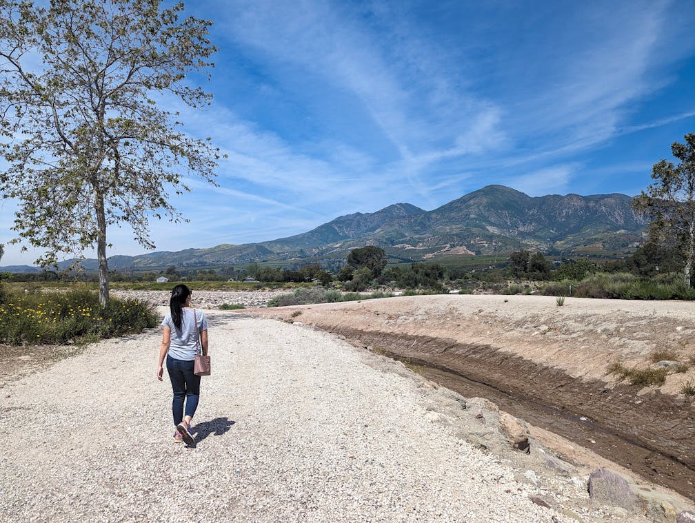
How to get small-town charm without the big road trip? Fill up on Fillmore! This picturesque city in the Santa Clara River Valley is framed by the hulking Topatopa Mountains and is known for its orange groves and its critical sanctuary for California condors. It’s an ideal day trip for finding good nature and delicious locally grown food. Explore it all via a 5-mile out-and-back walk (or bike ride) along the scenic pedestrian path, with stops at a local honey farm, fish hatchery, museum, bakery, and winery! You in? Let’s go!


Before arriving in Fillmore, beeline to Bennett’s Honey Farm off the CA-126. Producing local honey for over 40 years, Bennett’s offers every possible honey-related item you can imagine. Complimentary samples let you taste from a huge variety of Bennett’s unique local raw and unfiltered offerings.


They’re all delicious, but our favorites are the sage, buckwheat, avocado, wildflower, and hot honey flavors. You can also see a working display of the busy bees: Look for the queen and the drones. Next, head west on the CA-126 towards the Fillmore Trout Hatchery, stopping at Francisco’s Fruit Stand to snag some incredibly fresh local fruits on the way. At the hatchery, enjoy a small trail through a native plant garden and then grab some pellets to feed the resident rainbow trout, awaiting dispatch to local lakes.

In town, park at Main Street and Mountain View Street to find the beginning of Fillmore’s multi-use path. You’ll start your scenic walk right at the Fillmore Historical Museum (no fee), which features multiple historic buildings on an old train depot and an impressive array of artifacts, including a working music box from the early 1900s. It’s the best intro to the town, and the grounds are gorgeous.


Across the street is Giessinger Winery, perfect for a post-walk stop. Known for their dessert wines and ports, try the Forgiveness blend of Petite Sirah and Zinfandel, and the Cabernet Franc.


Continue past the beautiful city hall. Before following the train tracks along the trail, detour north on Central Avenue to see Fillmore’s main strip. It exudes classic small-town beauty and charm. A must stop: Roan Mills Bakery for fresh, locally produced baked goods made from wheat flour stone-ground on-site. Everything is good here (we especially liked the morning roll, savory Danish and turkey sandwich, paired with the bakery’s creative heritage valley latte: sage and coffee, anyone?).


Head back to the path, which often winds under towering sycamores, and continue northwest for 1.5 miles to reach Shiell’s Park. At the northwest end, the trail meanders along the Santa Clara River, framed by mountains and seasonal wildflowers.


It’s a nice spot for a picnic. The path heads south for another mile before it reaches the CA-126, a good turnaround spot, or you can head east on the 126 to get back to Main Street Park and your car. You’re Fillmore full!
To get to Bennett’s Honey Farm, take the I-5 to the CA-126 and head west for 13.5 miles. Take a right onto Honey Ln. and find parking at the end of the road on your right. To get to Fillmore from the Honey Farm, continue west on CA-126 for 5.6 miles and turn right onto Central Ave., followed by a right onto Main St. after 2 blocks. Find street parking after a quarter-mile, near the museum. Dog-friendly!
Story and photos by Matt Pawlik, @mattitudehikes


