Colorful Calero
Hike in South Bay at Calero County Park for wildflowers and views

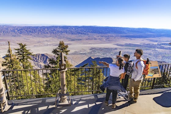
Tucked in the eastern foothills of the Santa Cruz Mountains, Calero County Park has a surprise side. Its 4,455 acres are home to a well-known reservoir that’s a central attraction for water activities. But venture into its “back country” in spring and discover its wild—and wildflower—side! An 8.5-mile rolling loop hike climbs and descends to provide spectacular vistas and a kaleidoscope of flora. Almost immediately you’ll be treated to yellow and orange fiddlenecks, California buttercups, pink checkerblooms, and views of Mount Diablo and Mount Hamilton to the east. Along the way, pass the Calero Bat Inn (yes, an inn for bats, who sleep here during the day).
Ascend through oak woodland and emerge into a meadow at the Cottle Rest Site, a good place to take a break on a picnic bench. The hike gets steep on the Chisnantuck Peak Trail, nearly a mile of narrow ascending switchbacks lined with wildflowers like lupine and filaree. Pop out to a meadow full of poppies and panoramic views: the Calero Reservoir, the bay further to the north, Mount Hamilton to the east, and Mount Umunhum and Loma Prieta to the west. The trail turns into Bald Peaks Trail and looks directly out to Umunhum, Loma Prieta, Bald Mountain, and even Fremont Peak in the distance. Continue on Bald Peaks for about 1.5 miles before making a left on Cañada del Oro Trail, which descends steeply and is mostly shaded. You’ll connect a few trails (see full directions below) before reaching a final meadow of flowers—a last look to savor before returning to the parking lot.
From southbound Almaden Expwy. in San Jose, turn right onto Harry Rd., then left onto McKean Rd. Continue past the reservoir entrance until you get to the large, dirt Calero parking lot. Parking here is free. From the Calero parking lot, take the short Access Trail and then stay right to get to Los Cerritos Trail. At the next intersection, make a left on the Peña Trail and continue your ascent for about a mile, then make a right on the Serpentine Loop towards the Calero Bat Inn. Keep right towards Cottle, then go left on the Cottle Trail. Ascend through the oak woodland until you emerge in a meadow at the Cottle Rest Site. From the rest area, take the Chisnantuck Peak Trail. Continue as the trail turns into Bald Peaks Trail and goes for about 1.5 miles before you turn left on Cañada del Oro Trail, which descends steeply. Briefly take Figueroa to the left to get to the Vallecito Trail and follow it until making a right on the Peña Trail to return the way you came towards the trailhead via the Los Cerritos and Access trails. Dog-friendly!


