Sunsational Mount Tam

Hike to the East Peak of Mount Tam in the San Francisco Bay Area

The East Peak of Mount Tamalpais State Park couldn’t be more accommodating: it’s reached via a short hike and easily gives visitors one of the best views in the Bay Area. Yet, like visiting Alcatraz, many of us just haven’t done it. There’s no time like now to make it happen.

Plan your arrival about an hour before sunset, and take the quarter-mile (one-way) walk up the Plank Trail to the 2,571-foot East Peak fire lookout and summit. On clear nights, it’s nothing but pure panoramic perfection. Mount Tam’s northern lakes wink like polished diamonds in the distance, and Mount Diablo and Mount St. Helena help complete a peak trifecta.
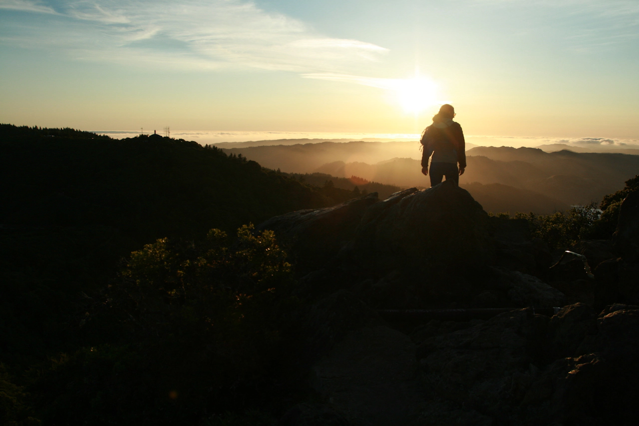
Whatever you do, don’t just cast your eyes west or you might miss an opportunity to catch Mount Tam’s giant pyramid-shaped shadow to the east. As the sun sets, the landscape is splashed in a tangerine shade, deepening into golden hues over the horizon. If it’s foggy? Even better. The coast exudes calmness, looking cozily covered by a fluffy blanket. Tam magical way to start the decade!

From Hwy. 101 in Marin, take the Stinson Beach/Hwy. 1 exit and go 1 mile to the stoplight at Hwy. 1. Turn left and go 2.5 miles to Panoramic Hwy. Turn right and stay on Panoramic Hwy. for 5 miles. Turn right on Pantoll Rd. and go 1.5 miles to Ridgecrest Blvd. Turn right and go 3 miles to the East Peak parking area. Dogs are OK in the parking lot. NOTE: You won’t be able to stay the entire duration of the sunset because a park ranger will come by to (kindly) boot you out instead of locking you in. Be sure to return to your car with some light left, if you stay that long. Park rangers will lock the gate to the parking area shortly after sunset.

Trending Stories NorCal

View all Stories
  1. Walk on the Wise Side

    A wise man once said, “Walk it off.” And San Francisco has just the place for a colorful walk via a 2.7-mile loop along Philosopher’s Way Trail in the 318-acre John McLaren Park (S

    View
  2. Hiker on the SCA trail in Marin Headlands with view of the Golden Gate Bridge

    Headlands Over Heels

    People come from all over the world to get a glimpse of the Golden Gate Bridge. Get a dramatic and novel view of the bridge without all the people on this moderate 6-mile hike in the Marin Headlands.

    View
  3. woman hiking Mt Tam east peak
    Sponsored

    Marquee Marin

    There may be no better place to find the best in coastal outdoors than the Marin Headlands. Bluff-side hiking trails, beautiful sandy beaches, big Pacific views, an iconic lighthouse, and unique lore in the area’s historic batteries are all part of the action here.

    View

Trending Stories SoCal

View all Stories
  1. Woman hiking the San Onofre Bluffs Loop Trail to San Onofre State Beach in San Diego County

    Bluffing Good!

    Lovely coastline, beautiful beaches, unique geological history, and picturesque sandstone cliffs with limited foot traffic in San Diego County? Head to San Onofre State Beach and the 5-mile San Onofre Bluffs Loop Trail.

    View
  2. Can We Get a Whoop Whoop!

    City, mountain, and ocean views all in one hike? Whoop whoop! It’s no surprise the the Kenter Fire Road and Whoop-de-Doos Trail (a combo of fire road and singletrack) is a favorite among local mountain bikers and hikers alike.

    View
  3. The Big Chill

    In LA, finding a place to chill can be the ultimate flex. So flex, in Franklin Canyon! This unexpected oasis has plenty of shade, cool lake breezes, and ample picnicking spots. Enjoy it on an easy-going 1-mile stroll along its reservoir and duck pond.

    View





