Bag Tahoe's Tallest

Hike to the peak of Mount Tallac in Tahoe

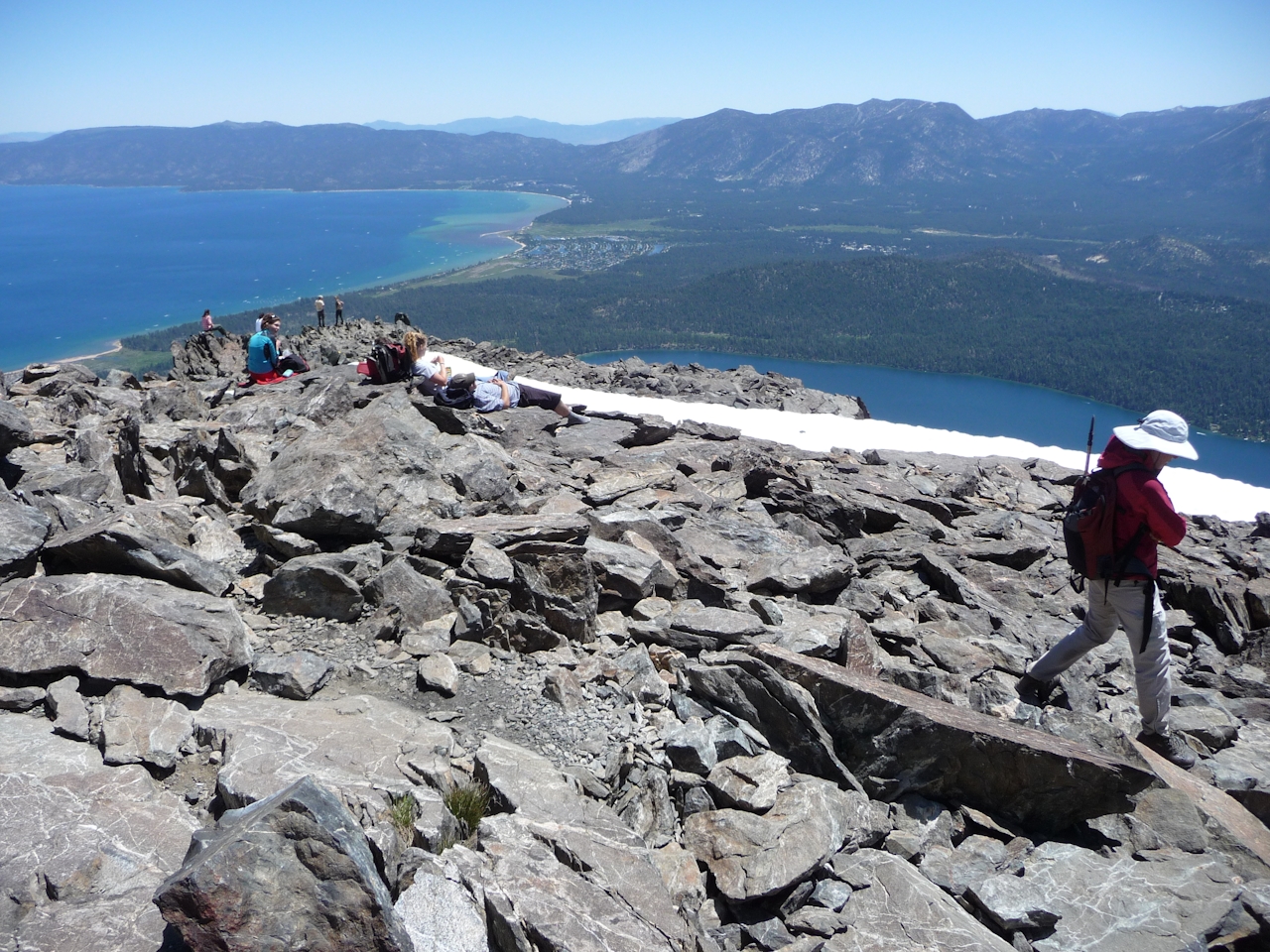
You can’t call yourself a Tahoe hiker until you’ve climbed 9,735-foot Mount Tallac, the imposing peak that towers over Lake Tahoe’s southwest shore. This butt-kicking, 9.4-mile hike (round-trip) boasts 3,400 feet of elevation gain (pack plenty of food and water). The Mount Tallac Trail starts out deceptively easy as it climbs the glacial moraine that hems in beautiful Fallen Leaf Lake. Savor the double lake view with Fallen Leaf in the foreground and Tahoe beyond. In 1.5 miles, you’ll reach grassy Floating Island Lake, then a mile later, tiny, rockbound Cathedral Lake.

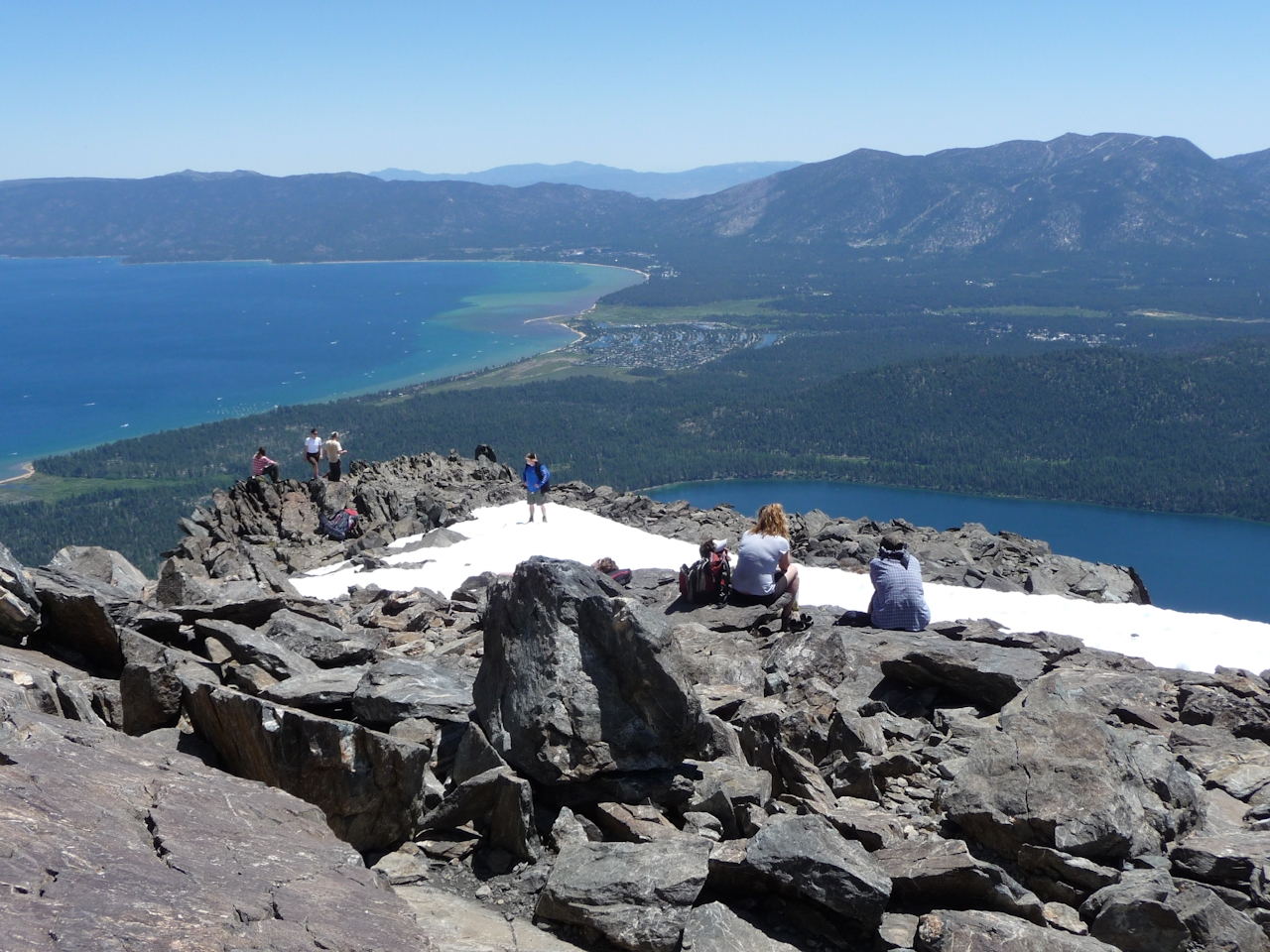
Rest and fuel up, because the going now gets tough as you face a punishing 2,100-foot gain over 2.2 miles. Your thighs will burn traversing to Tallac’s southwest side, then ascending the jagged metamorphic rocks that mark the tip-top. Now your biggest dilemma is deciding which way to look. To the north are Cascade Lake, Emerald Bay, and giant Tahoe. To the east is Fallen Leaf Lake, and to the west and south are the lake-laden basins of the Desolation Wilderness. Spin around and take it all in. And yes, do a summit selfie!
Tip: Another trail leads to Tallac from the Glen Alpine Trailhead at Fallen Leaf Lake, but it’s about one mile longer.

From the Y-junction of U.S. 50 and Hwy. 89 in South Lake Tahoe, drive 3.5 miles northwest on Hwy. 89 to the turnoff for the Mount Tallac Trailhead (across from Baldwin Beach). Turn left and drive 0.4 mile, then turn left and drive 0.6 mile to the trailhead. Day hikers must fill out a self-serve wilderness permit at the trailhead. Dog-friendly!

Trending Stories NorCal

View all Stories
  1. Woman with her arms outstretched to the rolling hills scenery while on a rock outcrop at Barnabe Peak in Samuel P Taylor Sate Park in Marin

    Barnabe Bonanza

    Sure, there are higher mountains in Marin (Mount Tam) and easier ascents (Mount Burdell), but is there a more expansive North Bay view? Barnabe Peak in Samuel P. Taylor State Park offers a glorious panorama including Mount Tam, Mount Diablo, and Mount St. Helena.

    View
  2. Hiker on the SCA trail in Marin Headlands with view of the Golden Gate Bridge

    Headlands Over Heels

    People come from all over the world to get a glimpse of the Golden Gate Bridge. Get a dramatic and novel view of the bridge without all the people on this moderate 6-mile hike in the Marin Headlands.

    View
  3. Cheers to Chimney

    If you’re looking for all that Point Reyes has to offer in spring, Chimney Rock is the place to be. The 1.75-mile (round-trip) hike to Chimney may be short, but it packs a visual punch, quadrupling the viewing thrills during spring.

    View

Trending Stories SoCal

View all Stories
  1. Woman hiking the San Onofre Bluffs Loop Trail to San Onofre State Beach in San Diego County

    Bluffing Good!

    Lovely coastline, beautiful beaches, unique geological history, and picturesque sandstone cliffs with limited foot traffic in San Diego County? Head to San Onofre State Beach and the 5-mile San Onofre Bluffs Loop Trail.

    View
  2. Can We Get a Whoop Whoop!

    City, mountain, and ocean views all in one hike? Whoop whoop! It’s no surprise the the Kenter Fire Road and Whoop-de-Doos Trail (a combo of fire road and singletrack) is a favorite among local mountain bikers and hikers alike.

    View
  3. The Big Chill

    In LA, finding a place to chill can be the ultimate flex. So flex, in Franklin Canyon! This unexpected oasis has plenty of shade, cool lake breezes, and ample picnicking spots. Enjoy it on an easy-going 1-mile stroll along its reservoir and duck pond.

    View