Ojai There!

Ride the Ventura to Ojai Bike Path

Woman biking the Ventura to Ojai bike path in Ventura County

If a substantive and super scenic bike ride is right in your wheelhouse, do the 30-mile (round-trip) Ventura-to-Ojai bike path that begins (and ends) near the Ventura shoreline. You'll pedal along the Ventura River and stop in delightful Ojai at the base of the Los Padres National Forest.

Woman riding her bike over a bridge on the Ventura to Ojai bike path

Woman bike riding next to a ranch fence and pastoral landscape with trees on the Ventura to Ojai bike trail

Start at one of several paved path entries near downtown Ventura and begin your 15-mile (one-way) route that gently and gradually climbs over 800 feet on the way to Ojai.

The journey mostly parallels the CA-33 and the Ventura River with a wide variety of scenery, starting with oil derricks and passing metal mile markers with inspiring quotes to energize you. Look also for Ventura Spirits, a craft distillery that is right off the path and worth a stop.

Bike rider on a floral section of the Ojai to Ventura bike trail with a palm tree in the foreground

The winding route becomes more scenic as you pass by parks, campgrounds, and hiking trails that veer off into the chaparral, with green hills in the background. Other highlights include a quaint bridge passing over San Antonio Creek and incredible valley views upon reaching the small town of Oak View. Look for a bench and painted rock garden after passing Santa Ana Boulevard—this is a great rest spot to soak in the panoramic vistas. 

Woman riding her bike on the Ventura to Ojai bike path

Man sitting on a bench overlooking the scenery on the Ventura to Ojai bike path

Woman biking the Ventura to Ojai bike path

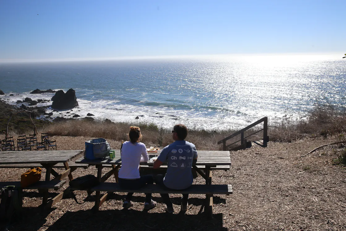
From here, it’s only about 5 miles to Ojai; the trail bends east at the outskirts of town at Rotary Community Park. Pass by Topa Mountain Winery (you can enter directly from the bike path) and soon reach Libbey Park, the town’s premier public green space and a great stopping point to park your bikes and have a picnic. Walk around, enjoying the town’s boutique shops and restaurants. For coffee, try Ojai Coffee Roasters; for beer, go for Topa Topa Brewery; and for burritos, head to Ojai Tortilla Factory. Don’t miss Bart’s Books, the famous local literature store that contains something for everyone in a beautiful setting.

Woman walking around looking at the books in the outdoor bookstore Barth's Books in Ojai California

When you’re refueled and ready, head back to your bikes at Libbey Park and hop on the trail for an easy, gradually descending 15-mile coast back to Ventura. Ride on!

E-bike Bonus: Too tired for such a long route? There’s a two-tire for that! Rent pedal-assist e-bikes from local spot eBike Adventure (Shepherd, the owner, is super friendly and has great rates!).

A couple on their bikes looking back to the camera smiling on the Ventura to Ojai bike path.

To get to a typical Ojai Valley Bike Trail starting point (this one at Rex St. and Dubbers St.), take the US-101 to the California St. exit in Ventura. After 3 blocks heading north, turn left onto Main St., followed by a right onto Olive St. Pass the CA-33 entrance and take the next left onto Rex St. to find the bike path (find street parking nearby). Dog-friendly (you can also walk along the bike path)!

Story and photos by Matt Pawlik.

Trending Stories NorCal

View all Stories
  1. Bear Hug

    This 5.5-mile loop through Coyote Lake-Harvey Bear Ranch County Park explores one of the newest segments of the acclaimed Bay Area Ridge Trail, one redolent with trees ranging from madrone and manzanita to buckeye and blue elderberry (with a bubbly post-hike bonus).

    View
  2. Field of Light at Sensorio in Paso Robles

    Light This Way

    Hidden in the bucolic hills of Paso Robles lies one of the greatest light shows on earth. The lighted art exhibition, Sensorio, is as if the rainbow magic of the aurora borealis was plucked from the sky and planted in the fields.

    View
  3. Bikers and walkers on the Bay Area Ridge Trail with the Golden Gate Bridge behind them

    National Park City Walk

    See San Francisco the way locals do by hiking the Presidio, a national park right in the city! Wooded trails, secluded beaches, and epic views of the Golden Gate Bridge feature on this 5.5-mile out-and-back on the Bay Area Ridge Trail. It’s a lovely slice of the City by the Bay.

    View
  4. Hike top Angel Island Mount Livermore San Francisco Bay

    Good Heavens

    The 4-mile hike to the top of Angel Island offers Bay-mazing scenery. Some people claim you get a five-bridge view: Richmond-San Rafael, Bay, Golden Gate, San Mateo-Hayward, and Dumbarton bridges.

    View

Trending Stories SoCal

View all Stories
  1. Sponsored

    Tram to Cool Treks

    Elevate your fun, getting whisked from palm trees to alpine wilderness on the world’s largest rotating tramcar. The Palm Springs Aerial Tramway transports you up and away on a 2.5-mile scenic route from the desert floor to the refreshing wilderness of Mount San Jacinto State Park.

    View
  2. Coming Up Roses

    Looking to spice up your hiking life? Give your partner a rose—Mount Rose! The 10-mile out-and-back peak hike goes up to one of the grandest views in all of Lake Tahoe. Get ready f

    View
  3. A group of people clamored around the summit marker at Mission Peak in the Bay Area

    Your Mission Is Less Crowded

    Mission Peak is one of the Bay Area’s most popular mountains, with many hikers climbing every weekend. Skip the crowds with this 6-mile loop up the less-traveled southern route.

    View
  4. Bucks Up!

    Come on in, the water is beautiful. Whether you like swimming, kayaking, stand-up paddling, or heading out on a bigger boat, Bucks Lake is a high mountain haven that’s easy to access, blissfully uncrowded, and surrounded by sandy beaches, picnic areas, pines, and aspens.

    View